
Old maps have a fascinating allure for collectors, historians, and enthusiasts alike. Whether you’re drawn to the intricate designs, the historical significance, or the artistic craftsmanship, antique maps offer a window into the past. In this article, we explore the most popular types of Old Maps for Collectors that collectors seek, diving into their unique characteristics, historical importance, and what makes them so valuable in today’s market.
1. Early World Maps: Unveiling the Unknown
World maps from the 15th to 17th centuries were among the earliest cartographic representations of the earth. These maps, often incomplete and wildly inaccurate by modern standards, provide a glimpse into how ancient civilizations viewed the world. Many early maps featured terra incognita—unknown lands—which reflected the explorers’ understanding at the time.
Why Collect Early World Maps?
Collectors of early world maps are often captivated by their artistic and symbolic representations of the world. The craftsmanship involved in hand-drawn maps of this era, with their ornate compass roses and sea monsters decorating unknown territories, makes them highly desirable. The most famous examples include Ptolemaic maps, based on the work of the Greco-Roman scholar Claudius Ptolemy, and the Mappa Mundi, a medieval European map illustrating both geographical and biblical elements.
2. Portolan Charts: Maps of Maritime Exploration
The portolan charts of the 13th to 17th centuries were primarily used by mariners navigating the Mediterranean and European coasts. These maps were revolutionary for their time because they used rhumb lines—a network of compass directions that allowed sailors to chart a straight course between two points. Portolan maps are renowned for their accuracy in depicting coastlines and harbors.
Why Collect Portolan Charts?
Collectors value portolan charts for their utilitarian beauty. Often drawn on parchment or vellum, these maps were prized possessions for sailors. They are characterized by their detailed coastal features, wind roses, and hand-colored highlights. Some of the most sought-after portolan charts come from Italian and Portuguese cartographers, whose expertise in maritime navigation shaped the Age of Discovery.
3. Thematic Maps: A Visual Record of Social and Economic Trends
Thematic maps emerged in the 19th century and represented a shift in cartography from purely geographical depictions to data-driven visualizations. These maps often showed population distribution, climate zones, or economic activity. Thematic maps are especially valuable to historians because they provide insights into the social, economic, and environmental conditions of a particular period.
Why Collect Thematic Maps?
Collectors of thematic maps are often interested in the way these documents blend science with art. Maps such as John Snow’s cholera map of London or Charles Joseph Minard’s map of Napoleon’s Russian campaign are historical artifacts that provide a snapshot of a moment in time. These maps offer not only a geographic representation but also a deeper understanding of societal changes, making them prized collectibles.
4. Celestial Maps: Charting the Heavens
Celestial maps, dating back to ancient times, are some of the most beautiful and artistic representations of cartography. These maps were used to chart the positions of the stars, constellations, and other celestial bodies. During the Renaissance, celestial maps became more detailed and accurate, serving both astronomical and astrological purposes. These maps were often highly decorative, incorporating mythological figures and artistic embellishments.
Why Collect Celestial Maps?
Celestial maps attract collectors for their aesthetic appeal and historical importance. The combination of astronomy, mythology, and art makes these maps unique pieces that blend science with imagination. Collectors particularly prize works from cartographers like Johannes Blaeu and Andreas Cellarius, whose intricate and colorful designs are considered masterpieces.
5. City and Town Plans: Urban Cartography
City and town maps, particularly those created in the 16th and 17th centuries, are valuable records of urban development and architecture. These maps often provided a bird’s-eye view of a city, complete with detailed illustrations of streets, buildings, and landmarks. As cities grew and changed over time, these maps became historical snapshots of urban life.
Why Collect City and Town Maps?
Collectors of city and town plans are often drawn to the detailed depiction of historical urban environments. Maps like Jacques Androuet du Cerceau’s plans of French cities or John Rocque’s map of London are not only valuable for their cartographic precision but also for their artistic merit. These maps offer a glimpse into the daily life of people from different eras, showcasing architectural styles, city planning, and local geography.
6. Topographic Maps: The Lay of the Land
Topographic maps, which show the elevation and terrain of a given region, are an essential tool for geographers, engineers, and explorers. These maps became particularly prominent in the 18th and 19th centuries, as the need for detailed land surveys grew. Unlike earlier maps, topographic maps provide a three-dimensional view of the landscape, with contours representing hills, valleys, and mountains.
Why Collect Topographic Maps?
Collectors appreciate topographic maps for their precise detail and historical value. Early surveys of North America, for instance, provide invaluable insights into the colonization and development of the continent. The Ordnance Survey maps of Britain and Cassini’s maps of France are some of the most sought-after examples in the world of topographic cartography.
7. Military Maps: Strategy and Warfare
Military maps have been used throughout history to plan and execute campaigns. These maps often contain detailed information about terrain, troop movements, and strategic points. From the Napoleonic Wars to World War II, military maps were essential tools for generals and field commanders.
Why Collect Military Maps?
Collectors value military maps for their historical significance and their role in shaping pivotal moments in history. Maps from famous battles, like the Battle of Waterloo or the D-Day landings, provide insight into military strategy and decision-making processes. These maps are often rare, as many were used on the battlefield and did not survive the conflict.
Conclusion: The Allure of Old Maps
Old Maps for Collectors are more than just geographical representations—they are historical documents that provide insight into how people viewed and understood the world around them. Whether you are drawn to the artistry, the historical significance, or the technical achievement of these maps, there is no denying their enduring appeal to collectors.
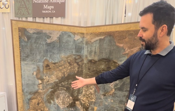
Go to Check – https://neatlinemaps.com/