Remote Sensing Software Market Outlook
The global remote sensing software market size reached a value of USD 1.67 billion in 2024. With the increasing adoption of geospatial technologies, advancements in satellite and aerial imagery, and growing demand across industries for real-time data analytics, the market is anticipated to expand further at a compound annual growth rate (CAGR) of 13.36% between 2025 and 2033. By the end of the forecast period, the market is projected to attain a value of USD 5.05 billion by 2033.
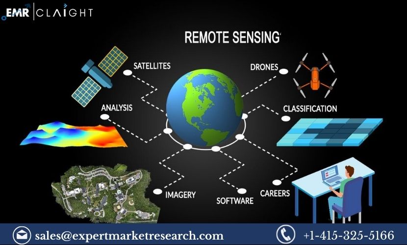
Remote sensing software plays a critical role in the collection, analysis, and interpretation of geospatial data obtained from various sensors such as satellites, drones, and airborne systems. These tools allow businesses, government agencies, and research institutions to access real-time, high-resolution data for applications ranging from environmental monitoring to disaster management. The growing reliance on remote sensing software in multiple sectors, including agriculture, defense, urban planning, and natural resource management, is propelling the growth of this market.
Drivers of Market Growth
One of the primary factors driving the growth of the remote sensing software market is the increasing adoption of geospatial technologies across various industries. Remote sensing software provides valuable insights by collecting data on Earth’s surface and atmosphere, helping organizations make informed decisions. The continuous advancements in satellite and drone technology have enhanced the accuracy, frequency, and resolution of the data being captured, creating new opportunities for the utilization of remote sensing software in several sectors.
In agriculture, remote sensing technology is increasingly being used for precision farming, enabling farmers to monitor crop health, soil conditions, and irrigation requirements more effectively. The integration of remote sensing software with other technologies like the Internet of Things (IoT) and artificial intelligence (AI) further enhances the capabilities of remote sensing tools, providing farmers with detailed insights for better decision-making. This, in turn, is helping to optimize crop yields, reduce resource usage, and minimize the environmental impact of agricultural practices.
The growing focus on environmental monitoring and sustainability also contributes significantly to the growth of the remote sensing software market . Remote sensing tools are being employed to monitor deforestation, soil degradation, water quality, and other environmental factors, providing governments and organizations with real-time data for better policy-making and resource management. This is particularly important in the context of climate change, where the need for precise environmental data has become more urgent. For example, remote sensing software is widely used in tracking the impact of climate change on ecosystems, predicting natural disasters, and monitoring the effects of global warming.
Moreover, remote sensing technology has found numerous applications in urban planning and infrastructure development. In the context of rapid urbanization, cities are turning to remote sensing software to map out urban growth, plan infrastructure projects, and monitor environmental impacts such as air pollution and traffic congestion. The use of such technology enables city planners to make informed decisions, streamline urban development, and ensure that cities are resilient to future challenges, including climate change and population growth.
Get a Free Sample Report With Table Of Contents@ https://www.expertmarketresearch.com/reports/remote-sensing-software-market/requestsample
Technological Advancements
Technological advancements in satellite and aerial imaging technologies are also fueling the expansion of the remote sensing software market. High-resolution satellite imagery, coupled with cloud computing and AI-based data analytics, has transformed the capabilities of remote sensing systems. These technologies allow for the processing and analysis of vast amounts of data, providing accurate, real-time insights into Earth’s surface.
The integration of AI and machine learning (ML) with remote sensing software is enabling the automation of data analysis, reducing the time required to process and interpret large datasets. AI algorithms can detect patterns in satellite images, such as identifying land-use changes, detecting crop diseases, or forecasting weather patterns. Machine learning models can also be used to predict future trends, providing valuable foresight to organizations in sectors like agriculture, forestry, and disaster management.
Another noteworthy technological advancement is the growing use of unmanned aerial vehicles (UAVs) or drones in remote sensing. Drones provide high-resolution, real-time data at much lower costs compared to traditional satellite imagery. This makes remote sensing technology more accessible to a wide range of industries, including small-scale businesses and local governments. Drones are particularly useful in applications such as surveying, mapping, and environmental monitoring, where high levels of detail and accuracy are required.
Applications Across Industries
The remote sensing software market serves a wide array of industries, each with unique needs and applications. The agricultural sector is one of the largest users of remote sensing technology, particularly with the rise of precision farming techniques. Remote sensing software helps farmers assess crop health, predict yields, and optimize the use of fertilizers and pesticides. This reduces costs, increases efficiency, and promotes sustainable farming practices. The increasing global population and demand for food production are pushing the need for advanced farming solutions, further driving the adoption of remote sensing technology.
In the defense and security sector, remote sensing software is used extensively for surveillance, reconnaissance, and intelligence gathering. Satellite imagery and drone-based data collection are used to monitor borders, track enemy movements, and support military operations. The ability to access high-resolution images and real-time data provides defense agencies with a strategic advantage, enhancing national security efforts.
Another sector experiencing rapid growth in the use of remote sensing software is disaster management. Remote sensing tools are essential in monitoring and predicting natural disasters such as hurricanes, wildfires, and earthquakes. By analyzing satellite and aerial data, organizations can predict the occurrence of these events, track their progression, and respond more effectively. This enables timely evacuation, resource allocation, and post-disaster recovery efforts.
In addition, remote sensing software plays a vital role in environmental research and conservation efforts. Governments, NGOs, and research institutions are utilizing this technology to monitor and manage natural resources, track biodiversity, and assess the impact of human activities on the environment. For instance, satellite imagery is being used to monitor deforestation in the Amazon rainforest and assess the impact of illegal mining activities in Africa.
The energy sector also leverages remote sensing software for resource exploration and infrastructure monitoring. Oil and gas companies use satellite data to survey potential drilling sites and monitor pipelines for leaks. Solar and wind farms utilize remote sensing tools to assess energy production potential and optimize the placement of solar panels or wind turbines. As the push for renewable energy grows, the energy sector’s reliance on remote sensing technology is expected to increase.
Remote Sensing Software Market Segmentation
The market can be divided based on component, deployment model, by type, application, end user, and region.
Breakup by Component
- Software
- Service
Breakup by Deployment Model
- On-Premises
- Cloud
Breakup by Type
- Web Based
- Mobile
Breakup by Application
- Ground Based
- Satellite
- Airborne
Breakup by End-User
- Defence
- Commercial
Market Breakup by Region
- North America
- Europe
- Asia Pacific
- Latin America
- Middle East and Africa
Competitive Landscape
Some of the major players explored in the report by Expert Market Research are as follows:
- Hexagon AB
- BAE Systems plc
- Harris Geospatial Solutions, Inc.
- Merrick & Company
- Textron Systems
- Others
Challenges and Market Restraints
Despite the promising growth prospects, there are several challenges that could hinder the growth of the remote sensing software market. One of the main challenges is the high cost of satellite launches and maintenance, which can limit access to remote sensing technology for smaller organizations or developing nations. Additionally, the complexity of processing and analyzing large datasets often requires specialized skills and infrastructure, which could create barriers for some users.
Data privacy and security concerns are also emerging as significant challenges in the market. As remote sensing software often relies on collecting and analyzing sensitive data, ensuring the protection of this information is crucial for maintaining trust and compliance with regulations.
Media Contact:
Company Name: Claight Corporation
Contact Person: George buttler, Corporate Sales Specialist – U.S.A.
Email: sales@expertmarketresearch.com
Toll Free Number: +1-415-325-5166 | +44-702-402-5790
Address: 30 North Gould Street, Sheridan, WY 82801, USA
Website: http://www.expertmarketresearch.com
Aus Site: https://www.expertmarketresearch.com.au


